


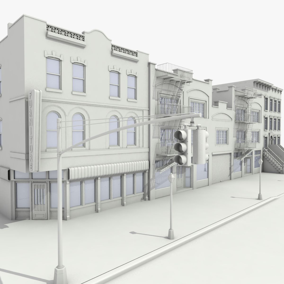


Amaryllis City Modello 3D
129


Licenza d'uso personale
8,763
visite
3,492
download

Inviato da
bluecoreproductions
specificazioni
- GeometriaPolygon mesh
- poligoni61,895
- vertici0
- TexturesYes
- materialeYes
- riggedNo
- AnimatoNo
- Prontabile in 3DYes
- Gioco pronto (low poly)Yes
- UV mappatoNo
Descrizione
Amaryllis City is a city located on the eastern part of central Oranova. The city’s center is connected by two land routes and one water route. To the north is Route 6, which leads to Hydrangea City. Also known as the Foothills Scenic Trail, this route takes you on a winding path across rocky outcrops on sloping terrains higher than the Lycoris Hills. To the southwest is Route 5, which leads to Camellia City. This route is known as the Lycoris Hills Greenway, and goes through a range of tree covered hills with great views of the surrounding area. To the east of the city is Route 14, a water route that goes across the Calendula Bay to Bourvadia Town. This route is known as the Calendula Bay Link.
Originally a rural area with many orchards, Amaryllis City has moved on to become a major commercial center, due to the influx of technology companies coming into central Oranova, which has brought many new office buildings and hotels to its landscape. This has caused the city to be the center for urban sprawl, and is increasingly growing each year.
Places of Interest in Amaryllis City
Amaryllis Arboretum
The Amaryllis Arboretum is an arboretum and botanical garden located on the southern part of the city. The arboretum contains over 200 species of trees, shrubs, flowers, and herbs, and includes nature walks and hiking trails.
Amaryllis City Music Center
The Amaryllis City Music Center, better known by locals as simply the A.C.M.C., is a 3,850–seat live music venue that is well known hosting over 100 concerts a year. It also serves as the home for television music programs such as Amaryllis City Limits, a long-running concert series that celebrates the various genres of music found across Oranova. Amaryllis City Philharmonic is also headquartered here and is symphony orchestra that brings classical and epic music into the 21st century.
Amaryllis Visitors’ Center
The Visitors’ Center provides great information about the history and geography of Amaryllis City and its vicinity. There are plenty of interactive exhibits to attract and engage tourists about the area.
Amaryllis Square
Amaryllis Square is a public square that has many events and interactive activities such as outdoor movies, concerts, outdoor dining, and farmer's markets.
Amaryllis Bluffs Regional Park
Amaryllis Bluffs Regional Park is an Oranova Regional Park located east of Amaryllis City, along the shores of the Calendula Bay. The park has nature trails down the cliffs to the water, along with wonderful vistas and close-up views of the bluffs. Each year, millions of tourists come to the Amaryllis Bluffs to admire their beauty and natural setting. The beaches at the foot of the bluffs are of an elegant white color.
Consisting of small quartz and granite particles, this sand came from a process involving the Aralia Mountains and the Calendula River 20,000 years ago. At the end of the last Ice Age, when the temperatures began warming and the ice caps began melting, large volumes of water were carried by the rivers to the world’s oceans. The Calendula River, rising in the Aralia Mountains, carried that water to the Gulf of Oranova and continues today. This process has happened for thousands of years, and the river has expanded and widened to the point of forming a large estuary, now known as the Calendula Bay.
This water carried the granite and quartz particles from the rock that forms the Aralia Mountains and deposited them in the Gulf of Oranova, several miles to the north of what is now Amaryllis City. As the sea level began to rise, these quartz sands eventually formed a new shoreline, and because of this, the sands continually get replenished each year.
Amaryllis Point
Included in the park is Amaryllis Point. This is one of the three geographical points along a large headland in central Oranova. Of all them, Amaryllis Point is the highest, being 36 feet above sea level. There is a trail in the adjacent Amaryllis Arboretum that provides great views of the area.
Amaryllis Carillon Tower
The Amaryllis Carillon Tower is a 155-foot-tall carillon-clock tower that is included in the Amaryllis Bluffs Regional Park. The tower and carillon was recently built, and is a popular destination for tourists in Amaryllis City. It has 62 bells and a range span of 5 octaves. The carillon chimes each quarter of the hour from 8 A.M. to 8 P.M. with many different tunes being played at various times of the day. It is located on top of a large stone wall that overlooks the Calendula Bay.
Lycoris Hills Regional Park
Lycoris Hills Regional Park is an Oranova Regional Park located to west of Amaryllis City. The park covers most of the gently rolling hills, which remain an important part of central Oranova’s physical geography. Many Pokémon call this park their home, and it acts as an ecoregion for them. The park offers nature walks and hiking trails along rolling hills, ravines, and gullies covered by subtropical coniferous forest, with a few streams running through parts of the area.
The highest point in the Lycoris Hills is Overlook Hill at 450 feet above sea level, located halfway between Camellia City and Amaryllis City. The summit is also located right next to Route 5. In the Amaryllis area, the highest point in the range is Amaryllis Hill at 356 feet above sea level, located south of Route 5, with the Amaryllis Arboretum right at the foot of it.
In the northernmost parts of the range, the Lycoris Hills start transitioning into the Foothills of the Aralia Mountains. Unlike the low-lying hills in the south, these hills have more rockier terrain, with plateaus, gorges, and waterfalls occurring throughout this area. The Foothills help form the lowest segment of the Aralia Mountains, the largest mountain range in east Oranova.
Originally a rural area with many orchards, Amaryllis City has moved on to become a major commercial center, due to the influx of technology companies coming into central Oranova, which has brought many new office buildings and hotels to its landscape. This has caused the city to be the center for urban sprawl, and is increasingly growing each year.
Places of Interest in Amaryllis City
Amaryllis Arboretum
The Amaryllis Arboretum is an arboretum and botanical garden located on the southern part of the city. The arboretum contains over 200 species of trees, shrubs, flowers, and herbs, and includes nature walks and hiking trails.
Amaryllis City Music Center
The Amaryllis City Music Center, better known by locals as simply the A.C.M.C., is a 3,850–seat live music venue that is well known hosting over 100 concerts a year. It also serves as the home for television music programs such as Amaryllis City Limits, a long-running concert series that celebrates the various genres of music found across Oranova. Amaryllis City Philharmonic is also headquartered here and is symphony orchestra that brings classical and epic music into the 21st century.
Amaryllis Visitors’ Center
The Visitors’ Center provides great information about the history and geography of Amaryllis City and its vicinity. There are plenty of interactive exhibits to attract and engage tourists about the area.
Amaryllis Square
Amaryllis Square is a public square that has many events and interactive activities such as outdoor movies, concerts, outdoor dining, and farmer's markets.
Amaryllis Bluffs Regional Park
Amaryllis Bluffs Regional Park is an Oranova Regional Park located east of Amaryllis City, along the shores of the Calendula Bay. The park has nature trails down the cliffs to the water, along with wonderful vistas and close-up views of the bluffs. Each year, millions of tourists come to the Amaryllis Bluffs to admire their beauty and natural setting. The beaches at the foot of the bluffs are of an elegant white color.
Consisting of small quartz and granite particles, this sand came from a process involving the Aralia Mountains and the Calendula River 20,000 years ago. At the end of the last Ice Age, when the temperatures began warming and the ice caps began melting, large volumes of water were carried by the rivers to the world’s oceans. The Calendula River, rising in the Aralia Mountains, carried that water to the Gulf of Oranova and continues today. This process has happened for thousands of years, and the river has expanded and widened to the point of forming a large estuary, now known as the Calendula Bay.
This water carried the granite and quartz particles from the rock that forms the Aralia Mountains and deposited them in the Gulf of Oranova, several miles to the north of what is now Amaryllis City. As the sea level began to rise, these quartz sands eventually formed a new shoreline, and because of this, the sands continually get replenished each year.
Amaryllis Point
Included in the park is Amaryllis Point. This is one of the three geographical points along a large headland in central Oranova. Of all them, Amaryllis Point is the highest, being 36 feet above sea level. There is a trail in the adjacent Amaryllis Arboretum that provides great views of the area.
Amaryllis Carillon Tower
The Amaryllis Carillon Tower is a 155-foot-tall carillon-clock tower that is included in the Amaryllis Bluffs Regional Park. The tower and carillon was recently built, and is a popular destination for tourists in Amaryllis City. It has 62 bells and a range span of 5 octaves. The carillon chimes each quarter of the hour from 8 A.M. to 8 P.M. with many different tunes being played at various times of the day. It is located on top of a large stone wall that overlooks the Calendula Bay.
Lycoris Hills Regional Park
Lycoris Hills Regional Park is an Oranova Regional Park located to west of Amaryllis City. The park covers most of the gently rolling hills, which remain an important part of central Oranova’s physical geography. Many Pokémon call this park their home, and it acts as an ecoregion for them. The park offers nature walks and hiking trails along rolling hills, ravines, and gullies covered by subtropical coniferous forest, with a few streams running through parts of the area.
The highest point in the Lycoris Hills is Overlook Hill at 450 feet above sea level, located halfway between Camellia City and Amaryllis City. The summit is also located right next to Route 5. In the Amaryllis area, the highest point in the range is Amaryllis Hill at 356 feet above sea level, located south of Route 5, with the Amaryllis Arboretum right at the foot of it.
In the northernmost parts of the range, the Lycoris Hills start transitioning into the Foothills of the Aralia Mountains. Unlike the low-lying hills in the south, these hills have more rockier terrain, with plateaus, gorges, and waterfalls occurring throughout this area. The Foothills help form the lowest segment of the Aralia Mountains, the largest mountain range in east Oranova.
Amaryllis City è una città situata nella parte orientale del centro di Oranova. Il centro della città è collegato da due vie terrestri e una via d'acqua. A nord è la Route 6, che porta a Hydrangea City. Conosciuto anche come Foothills Scenic Trail, questo percorso ti porta su un percorso tortuoso attraverso affioramenti rocciosi su terreni in pendenza più alti delle colline Lycoris. A sud-ovest si trova la Route 5, che conduce a Camellia City. Questo percorso è noto come Lycoris Hills Greenway e attraversa una serie di colline coperte di alberi con una splendida vista sulla zona circostante. Ad est della città si trova la Route 14, una via d'acqua che attraversa la baia di Calendula fino alla città di Bourvadia. Questo percorso è noto come Link alla baia di Calendula.
Originariamente una zona rurale con molti frutteti, Amaryllis City è diventata un importante centro commerciale, a causa dell'afflusso di aziende tecnologiche provenienti dal centro di Oranova, che ha portato molti nuovi edifici per uffici e hotel nel suo paesaggio. Ciò ha causato alla città il centro per lo sprawl urbano, e cresce ogni anno di più.
Luoghi di interesse nella città di Amaryllis
Amaryllis Arboretum
L'Amaryllis Arboretum è un arboreto e giardino botanico situato nella parte meridionale della città. L'arboreto contiene oltre 200 specie di alberi, arbusti, fiori ed erbe e comprende passeggiate nella natura e sentieri escursionistici.
Amaryllis City Music Center
L'Amaryllis City Music Centre, meglio conosciuto dalla gente del posto come semplicemente l'ACMC, è una sede di musica dal vivo di 3.850 posti, che è ben conosciuta e ospita oltre 100 concerti all'anno. Serve anche come sede di programmi musicali televisivi come Amaryllis City Limits, una serie di concerti di lunga data che celebra i vari generi musicali presenti in tutta Oranova. L'Amaryllis City Philharmonic ha anche sede qui ed è un'orchestra sinfonica che porta la musica classica ed epica nel 21 ° secolo.
Centro visitatori Amaryllis
Il Centro visitatori offre ottime informazioni sulla storia e la geografia della città di Amaryllis e dei suoi dintorni. Ci sono un sacco di mostre interattive per attirare e coinvolgere i turisti sulla zona.
Amaryllis Square
Amaryllis Square è una piazza pubblica che ha molti eventi e attività interattive come film all'aperto, concerti, cene all'aperto e mercati dei contadini.
Parco regionale di Amaryllis Bluffs
Amaryllis Bluffs Regional Park è un parco regionale di Oranova situato ad est della città di Amaryllis, lungo le rive della baia di Calendula. Il parco ha percorsi naturalistici lungo le scogliere verso l'acqua, con viste meravigliose e viste ravvicinate delle scogliere. Ogni anno, milioni di turisti vengono ad Amaryllis Bluffs per ammirare la loro bellezza e il loro ambiente naturale. Le spiagge ai piedi delle scogliere sono di un elegante colore bianco.
Composta da piccole particelle di quarzo e granito, questa sabbia proviene da un processo che coinvolge le montagne Aralia e il fiume Calendula 20.000 anni fa. Alla fine dell'ultima era glaciale, quando le temperature iniziarono a scaldarsi e le calotte polari iniziarono a sciogliersi, grandi quantità d'acqua furono portate dai fiumi agli oceani del mondo. Il fiume Calendula, che si erge sulle montagne dell'Aralia, portò quell'acqua nel Golfo di Oranova e continua ancora oggi. Questo processo è avvenuto da migliaia di anni e il fiume si è ampliato e allargato fino a formare un grande estuario, ora noto come la baia di Calendula.
Quest'acqua trasportava le particelle di granito e di quarzo dalla roccia che forma le montagne di Aralia e le depositava nel Golfo di Oranova, diverse miglia a nord di quella che ora è la città di Amaryllis. Con l'innalzarsi del livello del mare, queste sabbie di quarzo hanno formato una nuova costa, e per questo motivo le sabbie vengono continuamente riempite ogni anno.
Amaryllis Point
Incluso nel parco è Amaryllis Point. Questo è uno dei tre punti geografici lungo un grande promontorio nel centro di Oranova. Di tutti loro, Amaryllis Point è il più alto, essendo 36 piedi sopra il livello del mare. C'è un sentiero nell'adiacente Amaryllis Arboretum che offre splendide viste sulla zona.
Amaryllis Carillon Tower
L'Amaryllis Carillon Tower è una torre dell'orologio da carillon alta 155 piedi che è inclusa nel parco regionale di Amaryllis Bluffs. La torre e il carillon sono stati recentemente costruiti, ed è una destinazione popolare per i turisti nella città di Amaryllis. Ha 62 campane e una gamma di 5 ottave. Il carillon suona ogni quarto d'ora dalle 8.00 alle 20.00 con molti brani diversi suonati in vari momenti della giornata. Si trova in cima a un grande muro di pietra che si affaccia sulla baia di Calendula.
Parco Regionale delle Colline di Lycoris
Il Lycoris Hills Regional Park è un parco regionale di Oranova situato ad ovest della città di Amaryllis. Il parco copre la maggior parte delle dolci colline, che rimangono una parte importante della geografia fisica centrale di Oranova. Molti Pokémon chiamano questo parco come loro casa e agisce come un'ecoregione per loro. Il parco offre passeggiate nella natura e sentieri lungo colline ondulate, gole e calanchi coperti da foreste di conifere subtropicali, con alcuni corsi d'acqua che attraversano parti della zona.
Il punto più alto delle Lycoris Hills è Overlook Hill a 450 piedi sul livello del mare, situato a metà strada tra Camellia City e Amaryllis City. La cima si trova proprio accanto alla Route 5. Nella zona di Amaryllis, il punto più alto della catena è la collina di Amaryllis a 356 metri sul livello del mare, situata a sud della Route 5, con l'Amaryllis Arboretum proprio ai piedi di essa.
Nelle parti più settentrionali della catena, le Colline Lycoris iniziano a transitare nelle Prealpi dei Monti Aralia. A differenza delle basse colline del sud, queste colline hanno un terreno più roccioso, con altipiani, gole e cascate che si verificano in questa zona. Le colline pedemontane contribuiscono a formare il segmento più basso delle montagne di Aralia, la più grande catena montuosa dell'Oranova orientale.
Originariamente una zona rurale con molti frutteti, Amaryllis City è diventata un importante centro commerciale, a causa dell'afflusso di aziende tecnologiche provenienti dal centro di Oranova, che ha portato molti nuovi edifici per uffici e hotel nel suo paesaggio. Ciò ha causato alla città il centro per lo sprawl urbano, e cresce ogni anno di più.
Luoghi di interesse nella città di Amaryllis
Amaryllis Arboretum
L'Amaryllis Arboretum è un arboreto e giardino botanico situato nella parte meridionale della città. L'arboreto contiene oltre 200 specie di alberi, arbusti, fiori ed erbe e comprende passeggiate nella natura e sentieri escursionistici.
Amaryllis City Music Center
L'Amaryllis City Music Centre, meglio conosciuto dalla gente del posto come semplicemente l'ACMC, è una sede di musica dal vivo di 3.850 posti, che è ben conosciuta e ospita oltre 100 concerti all'anno. Serve anche come sede di programmi musicali televisivi come Amaryllis City Limits, una serie di concerti di lunga data che celebra i vari generi musicali presenti in tutta Oranova. L'Amaryllis City Philharmonic ha anche sede qui ed è un'orchestra sinfonica che porta la musica classica ed epica nel 21 ° secolo.
Centro visitatori Amaryllis
Il Centro visitatori offre ottime informazioni sulla storia e la geografia della città di Amaryllis e dei suoi dintorni. Ci sono un sacco di mostre interattive per attirare e coinvolgere i turisti sulla zona.
Amaryllis Square
Amaryllis Square è una piazza pubblica che ha molti eventi e attività interattive come film all'aperto, concerti, cene all'aperto e mercati dei contadini.
Parco regionale di Amaryllis Bluffs
Amaryllis Bluffs Regional Park è un parco regionale di Oranova situato ad est della città di Amaryllis, lungo le rive della baia di Calendula. Il parco ha percorsi naturalistici lungo le scogliere verso l'acqua, con viste meravigliose e viste ravvicinate delle scogliere. Ogni anno, milioni di turisti vengono ad Amaryllis Bluffs per ammirare la loro bellezza e il loro ambiente naturale. Le spiagge ai piedi delle scogliere sono di un elegante colore bianco.
Composta da piccole particelle di quarzo e granito, questa sabbia proviene da un processo che coinvolge le montagne Aralia e il fiume Calendula 20.000 anni fa. Alla fine dell'ultima era glaciale, quando le temperature iniziarono a scaldarsi e le calotte polari iniziarono a sciogliersi, grandi quantità d'acqua furono portate dai fiumi agli oceani del mondo. Il fiume Calendula, che si erge sulle montagne dell'Aralia, portò quell'acqua nel Golfo di Oranova e continua ancora oggi. Questo processo è avvenuto da migliaia di anni e il fiume si è ampliato e allargato fino a formare un grande estuario, ora noto come la baia di Calendula.
Quest'acqua trasportava le particelle di granito e di quarzo dalla roccia che forma le montagne di Aralia e le depositava nel Golfo di Oranova, diverse miglia a nord di quella che ora è la città di Amaryllis. Con l'innalzarsi del livello del mare, queste sabbie di quarzo hanno formato una nuova costa, e per questo motivo le sabbie vengono continuamente riempite ogni anno.
Amaryllis Point
Incluso nel parco è Amaryllis Point. Questo è uno dei tre punti geografici lungo un grande promontorio nel centro di Oranova. Di tutti loro, Amaryllis Point è il più alto, essendo 36 piedi sopra il livello del mare. C'è un sentiero nell'adiacente Amaryllis Arboretum che offre splendide viste sulla zona.
Amaryllis Carillon Tower
L'Amaryllis Carillon Tower è una torre dell'orologio da carillon alta 155 piedi che è inclusa nel parco regionale di Amaryllis Bluffs. La torre e il carillon sono stati recentemente costruiti, ed è una destinazione popolare per i turisti nella città di Amaryllis. Ha 62 campane e una gamma di 5 ottave. Il carillon suona ogni quarto d'ora dalle 8.00 alle 20.00 con molti brani diversi suonati in vari momenti della giornata. Si trova in cima a un grande muro di pietra che si affaccia sulla baia di Calendula.
Parco Regionale delle Colline di Lycoris
Il Lycoris Hills Regional Park è un parco regionale di Oranova situato ad ovest della città di Amaryllis. Il parco copre la maggior parte delle dolci colline, che rimangono una parte importante della geografia fisica centrale di Oranova. Molti Pokémon chiamano questo parco come loro casa e agisce come un'ecoregione per loro. Il parco offre passeggiate nella natura e sentieri lungo colline ondulate, gole e calanchi coperti da foreste di conifere subtropicali, con alcuni corsi d'acqua che attraversano parti della zona.
Il punto più alto delle Lycoris Hills è Overlook Hill a 450 piedi sul livello del mare, situato a metà strada tra Camellia City e Amaryllis City. La cima si trova proprio accanto alla Route 5. Nella zona di Amaryllis, il punto più alto della catena è la collina di Amaryllis a 356 metri sul livello del mare, situata a sud della Route 5, con l'Amaryllis Arboretum proprio ai piedi di essa.
Nelle parti più settentrionali della catena, le Colline Lycoris iniziano a transitare nelle Prealpi dei Monti Aralia. A differenza delle basse colline del sud, queste colline hanno un terreno più roccioso, con altipiani, gole e cascate che si verificano in questa zona. Le colline pedemontane contribuiscono a formare il segmento più basso delle montagne di Aralia, la più grande catena montuosa dell'Oranova orientale.
Apr 23, 2018
Data aggiunta
Nov 20, 2019
ultimo aggiornamento
Commenti