


Gobekli Tepe - Scansione 3D Modello 3D
0


Licenza RoyaltyTutti gli usi estesi
Ritorni semplici
Miglior prezzo garantito
Funziona fuori dalla scatola
0
visite
Inviato da
Shaban Interactive
specificazioni
- Geometriapolygonal
- poligoni667,120
- vertici667,120
- TexturesYes
- riggedNo
- AnimatoNo
- Prontabile in 3DNo
- Gioco pronto (low poly)No
- UV mappatoNo
- UV non avvoltounknown
Descrizione
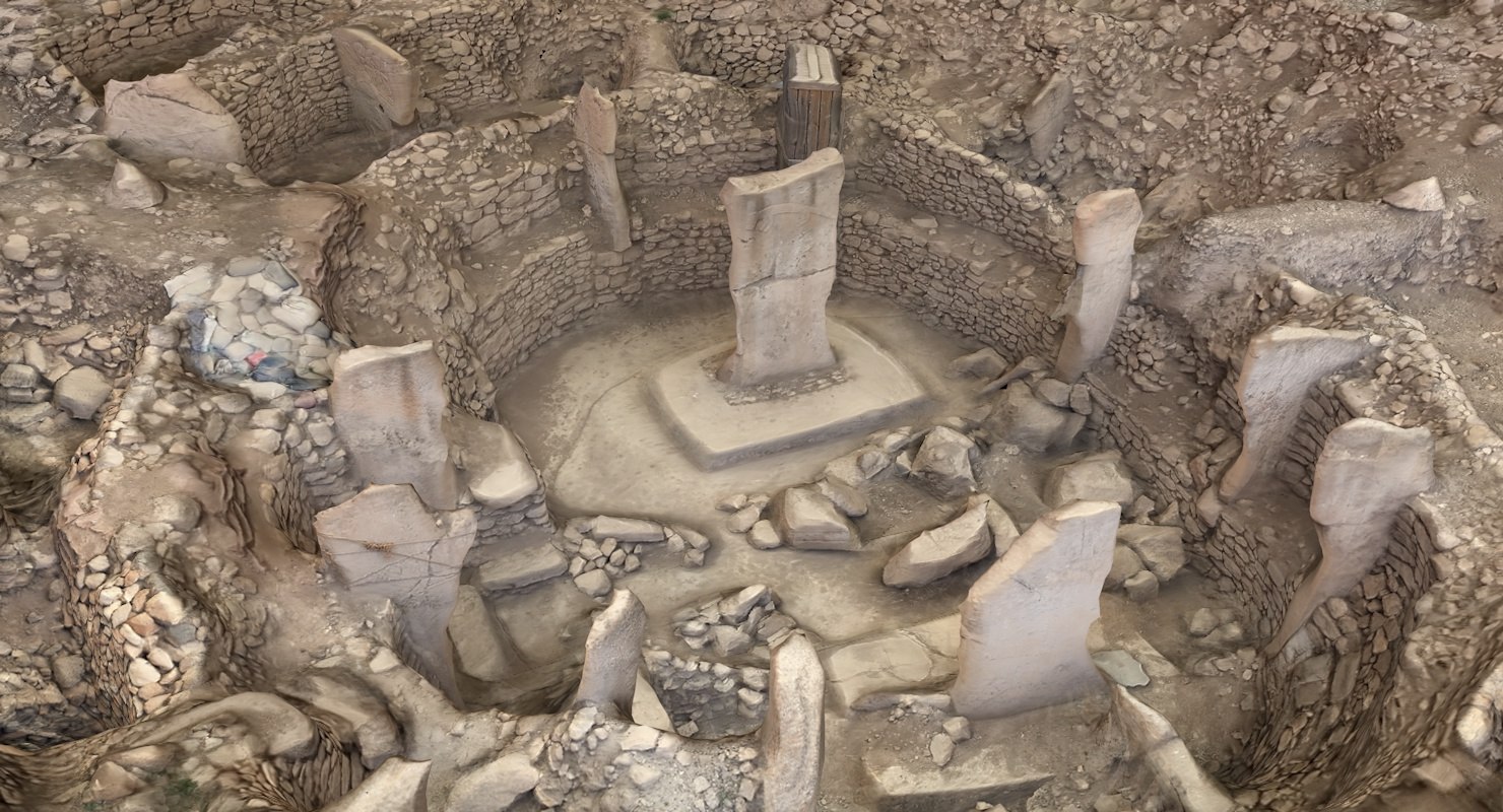
Gobekli Tepe is an archaeological site in the Southeastern Anatolia Region of Turkey, approximately 12 km (7 mi) northeast of the city of anlurfa. The tell has a height of 15 m (49 ft) and is about 300 m (980 ft) in diameter.[3] It is approximately 760 m (2,490 ft) above sea level.
The tell includes two phases of use believed to be of a social or ritual nature dating back to the 10th8th millennium BCE. During the first phase, belonging to the Pre-Pottery Neolithic A (PPNA), circles of massive T-shaped stone pillars were erected the world's oldest known megaliths.[4] More than 200 pillars in about 20 circles are currently known through geophysical surveys. Each pillar has a height of up to 6 m (20 ft) and weighs up to 10 tons. They are fitted into sockets that were hewn out of the bedrock.[5] In the second phase, belonging to the Pre-Pottery Neolithic B (PPNB), the erected pillars are smaller and stood in rectangular rooms with floors of polished lime. The site was abandoned after the PPNB. Younger structures date to classical times.
The details of the structure's function remain a mystery. It was excavated by a German archaeological team under the direction of Klaus Schmidt from 1996 until his death in 2014. Schmidt believed that the site was a sanctuary where people from a wide region periodically congregated, not a settlement.
In 2018, the site was designated a UNESCO World Heritage site.
Project Files Included.
*Texture Resolution: 8000x8000 pixels.
Sep 29, 2020
Data aggiunta
Feb 26, 2022
ultimo aggiornamento
Recensioni
Al momento non ci sono commenti per questo prodotto.
Perché non essere il primo a rompere il ghiaccio?