 3d model")


사해 지하 토양 표면 16K 3D 모델
0


0
방문
에 의해 제출 된
Asset Scan 3d
명세서
- 기하학polygonal_quads only
- 다각형16,500
- 정점들8,520
- 텍스처Yes
- 딱딱한No
- 생기 있는No
- 3D 인쇄 가능 준비No
- 게임 준비 (낮은 폴리)No
- UV 매핑 됨Yes
- 포장되지 않은 자외선non-overlapping
기술
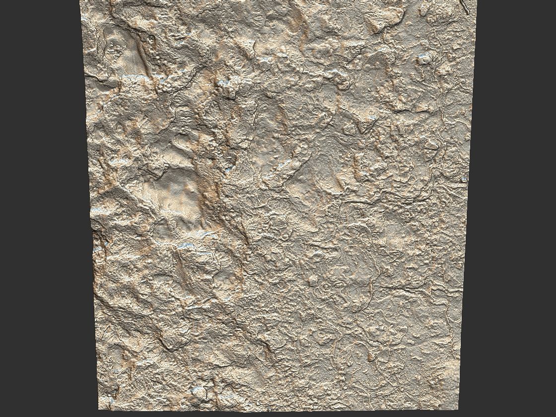
Dead Sea Ultra HD 16K
It will allow to make infinite 3d surfaces as ground of salt lake
Models scanned.
Amazing detail of the model.
UV map optimally packed
Includes 6 models in different resolutions.
HD & LP+ GAME READY
Models : HI / LP / LOD 16500 - 35026208 Faces
Quad model tessellation ready
Color Maps 16K 16386*16386
Normal Maps 4096 * 4096
Height Maps 4096 * 4096
Occlusion Map 4096 * 4096
Cavity Map 4096 * 4096
+
Loop Scan Textures
Color Maps 16K 16386*16386
Normal Maps 4096 * 4096
Height Maps 4096 * 4096
Occlusion Map 4096 * 4096
Cavity Map 4096 * 4096
Earth's lowest elevation on land. It is 304 m (997 ft) deep, the deepest hypersaline lake in the world. With a salinity of 342 g/kg, or 34.2% (in 2011), it is one of the world's saltiest bodies of water[7] 9.6 times as salty as the ocean and has a density of 1.24 kg/litre, which makes swimming similar to floating.[8][9] This salinity makes for a harsh environment in which plants and animals cannot flourish, hence its name. The Dead Sea's main, northern basin is 50 kilometres (31 mi) long and 15 kilometres (9 mi) wide at its widest point.[
Also check out my other models, just click on my user name to see complete gallery.
Asset scan 3d
Dec 28, 2019
추가 된 날짜
Oct 27, 2021
마지막 업데이트
리뷰
현재이 제품에 대한 리뷰가 없습니다.
얼음을 깬 첫 번째 사람이되지 않겠습니까?