


Катар 3d карта улиц города 3D модель
1


Бесплатная лицензияВсе расширенное использование
Простые возвращения
Гарантия лучшей цены
Работает из коробки
0
посещения
Представленный
Mousecg
Характеристики
- Геометрияpolygonal_ngons used
- Полигоны1,142,477
- вершины2,133,358
- текстурыNo
- подстроенныйNo
- мультипликационныйNo
- Готов к печати в 3DNo
- Игра готова (низкополигональная)No
- UV MappedYes
- Развернутые уфmixed
Описание
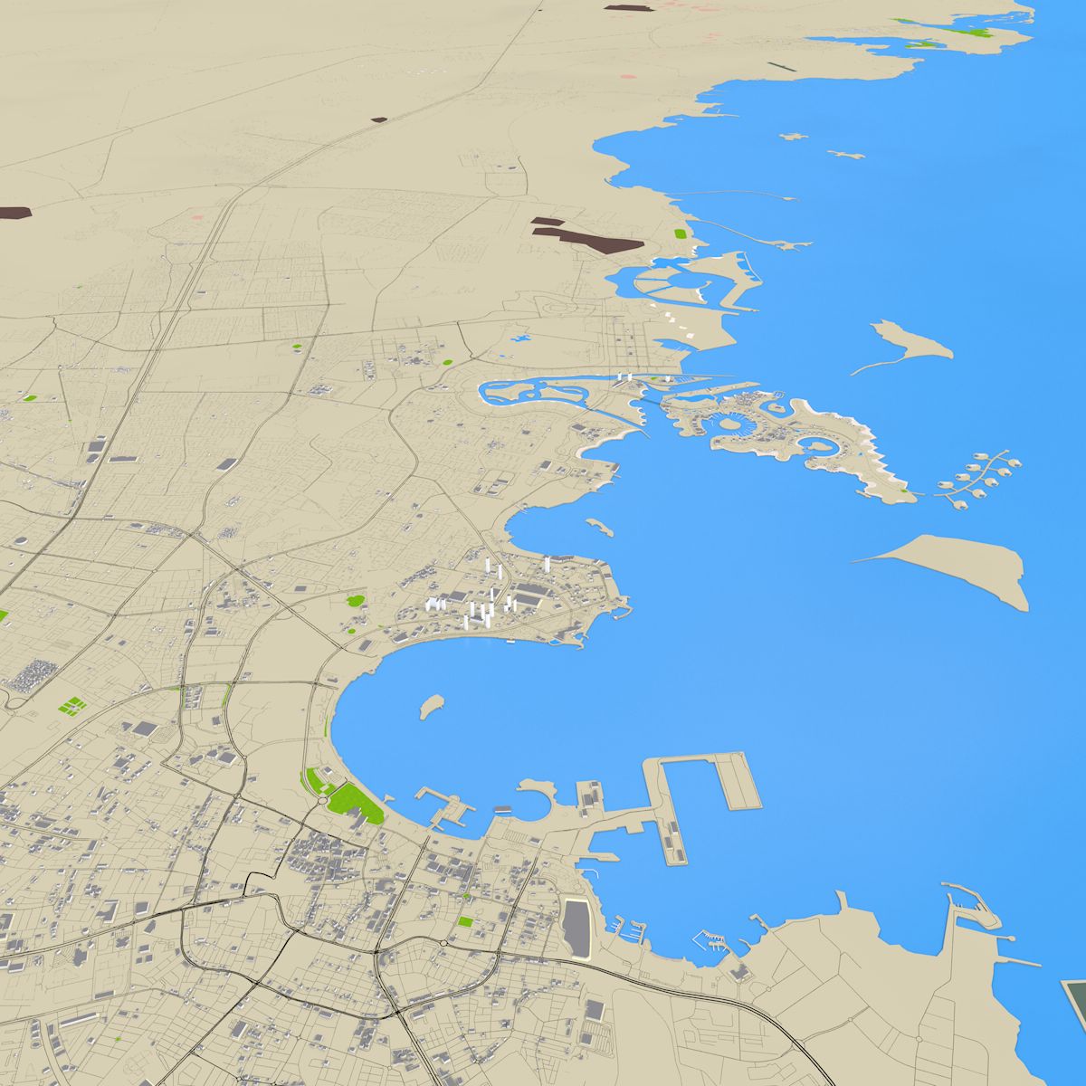
Accurate 3d representation of entire Qatar, province using 2019 map data. This scene contains accurate details of buildings, roads, land details, area details and water details.
Clean scene with properly grouped elements. All objects are properly arranged and added with proper name and materials. For user convenience the scene has proper hierarchy with layers, materials and groups.
Please note that there may be missing buildings because no such real world data available in the repository. Also included random buildings in certain area.
Buildings are extracted from real world data. There are random buildings added to some areas where real world data is partially available (missing height details).
Roads-Motorway,link,trunk,primary,secondary,tertiary,residential,aeroway,pedestrian,unclassified
River
Stream
Areas- building, car parking,park,playground, grass, farm yard, grave yard, forest, village green, water,aerodrome (air port),glacier, allotment,academic, meadow, nature reserve, military, garden, pitch, stadium,retail land, industrial land, commercial area, residential area, orchard, farm land, quarry
You can easily hide any layer/groups for better visualization.
Due to small size and minimum details this scene can be easily loaded.
Materials can easily be changed and altered.
Adding texture is easy, thanks to unique materials for each sections.
Only Cinema 4d file contains bezier curves. All other formats have polygon objects.
Map data :OpenStreetMap contributors
Zoom=25KM
Ratio: 1:1 004 242
3d scene scale : 1:1
Scene unit: cm
Please note: The over lapping areas shown in the renders are land use/ building type data, which I intentionally kept while rendering. You can easily hide those unwanted sections. For studies, land marking those data will be helpful.
There is no elevation data, bridge, tunnel data included.
Before purchasing thoroughly check the accompanying images. There is no texture, lighting, environment data are included.
This scene file is perfect for architectural, vfx renderings. You can easily apply projection mapping of real world images. Road, geographical map studies.
If you are planning to use in games some works required.
** Feel free to ask for file conversion**
Sep 29, 2020
Дата Добавлена
Aug 17, 2021
последнее обновление
Отзывы
На данный момент нет отзывов об этом продукте.
Почему бы не первым сломать лед?
