


İlçe Haritası - Washington 3D model
0


Royalty Free LisansTüm genişletilmiş kullanımlar
Basit iadeler
En iyi fiyat garantisi
Kutunun dışında çalışır
23
ziyaret
Tarafından gönderilmiştir
browntimmy
Özellikler
- Geometripolygonal_ngons used
- Çokgenler13,917
- Tepe Noktaları28,190
- DokularNo
- hileliNo
- canlandırılmışNo
- 3D Yazdırılabilir HazırNo
- Oyuna Hazır (düşük poli)No
- UV HaritalıYes
- Sarılmamış UV'lernone
Açıklama
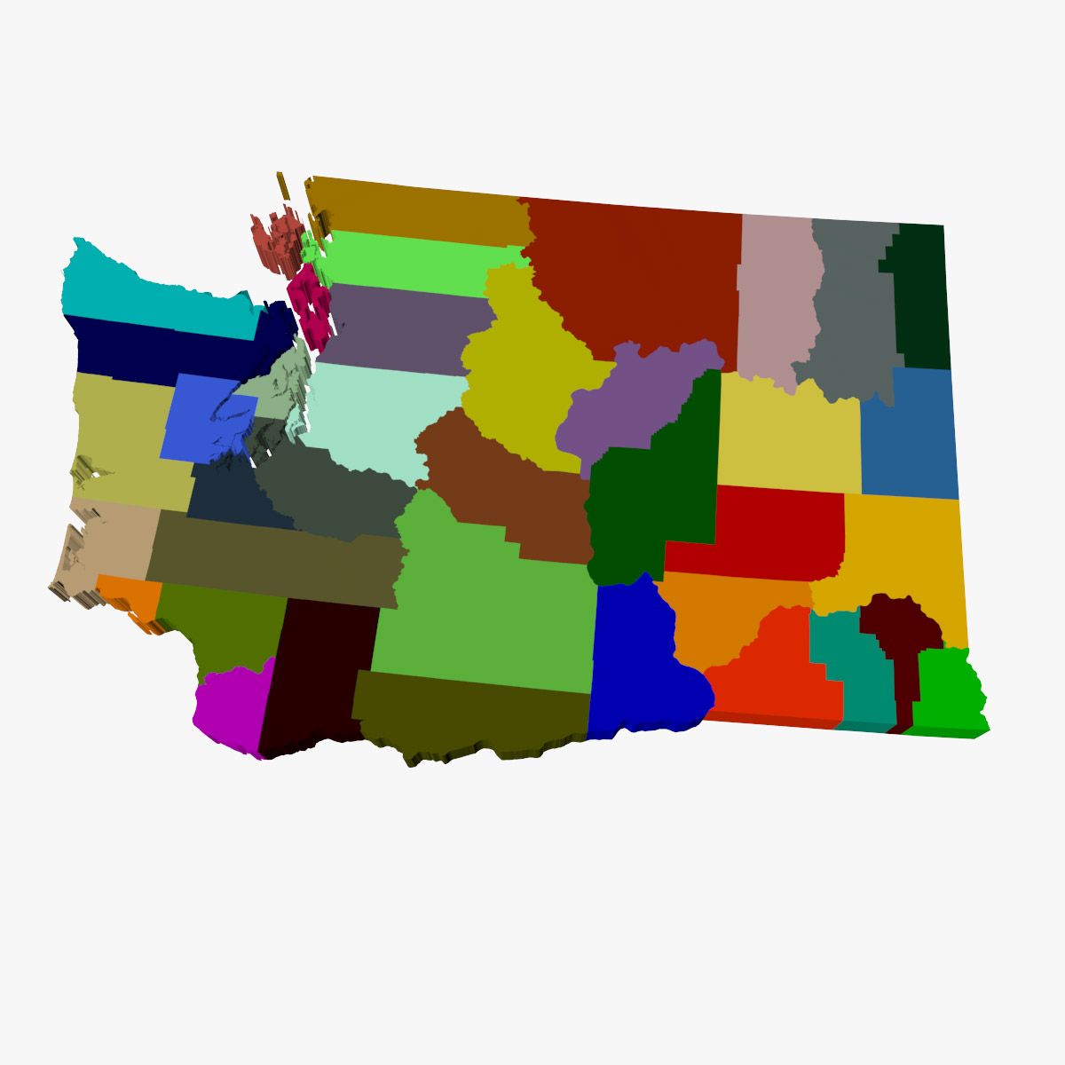
High detail map of the counties in the state of Washington. Consists of 39 separate shapes labeled after each of the 39 counties.
3ds max files consist of editable splines with Extrude modifiers applied, making the shapes very convenient to edit if necessary. Material modifiers also applied with individual sub-materials labeled after each county.
OBJ file compatible with Element 3D plugin for After Effects with each county able to be isolated.
Oct 15, 2019
Ekleme Tarihi
Oct 27, 2021
son Güncelleme
Yorumlar
Bu ürün için henüz hiç yorum yapılmamış.
Neden buzu kıran ilk kişi değilsin?

