


 3d model")
Israel and palestine Map 3D Model
0


19
visits
Submitted by
mageedalzaide
Specifications
- Geometrypolygonal
- Polygons466,550
- Vertices4,620,951
- TexturesNo
- RiggedNo
- AnimatedYes
- 3D Printable ReadyNo
- Game Ready (low poly)No
- UV MappedYes
- Unwrapped UVsnone
Description
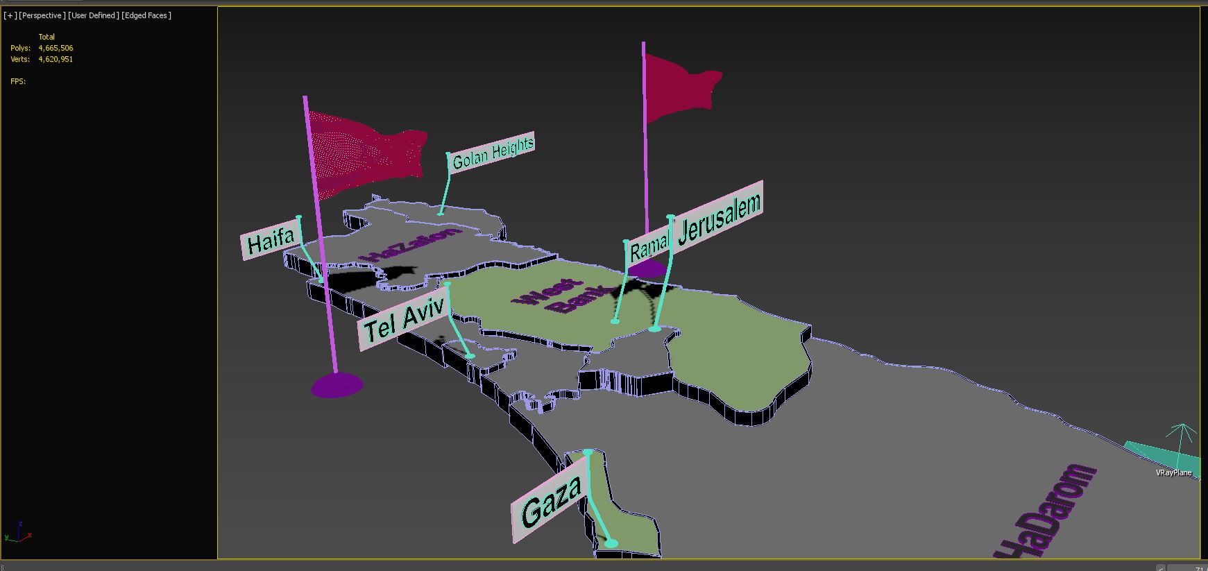
-3d model of the map of The Israel .
-Vray scene for 3dsmax 2018
-Flag Raising animation
-Includes all Provinces.
-with state Provinces.
-with cities and capital names.
-Every Provinces border is separate.
-no additional plugins are required for this product just vray v3.0 for render .
Useful for broadcast news shows and for elections.
Each state is beveled named and textured.
Modeled in 3DS Max 2014 and tested in different file formats.
Oct 17, 2019
date added
Dec 01, 2021
last update
Reviews
There are currently no reviews for this product.
Why not be the first one to break the ice?