


Mount Ararat Area Terrain 3D Model
0


3
visits
Submitted by
Gibmation
Specifications
- Geometrypolygonal_tris only
- Polygons11,462,472
- Vertices5,736,025
- TexturesYes
- RiggedNo
- AnimatedNo
- 3D Printable ReadyNo
- Game Ready (low poly)No
- UV MappedYes
- Unwrapped UVsnon-overlapping
Description
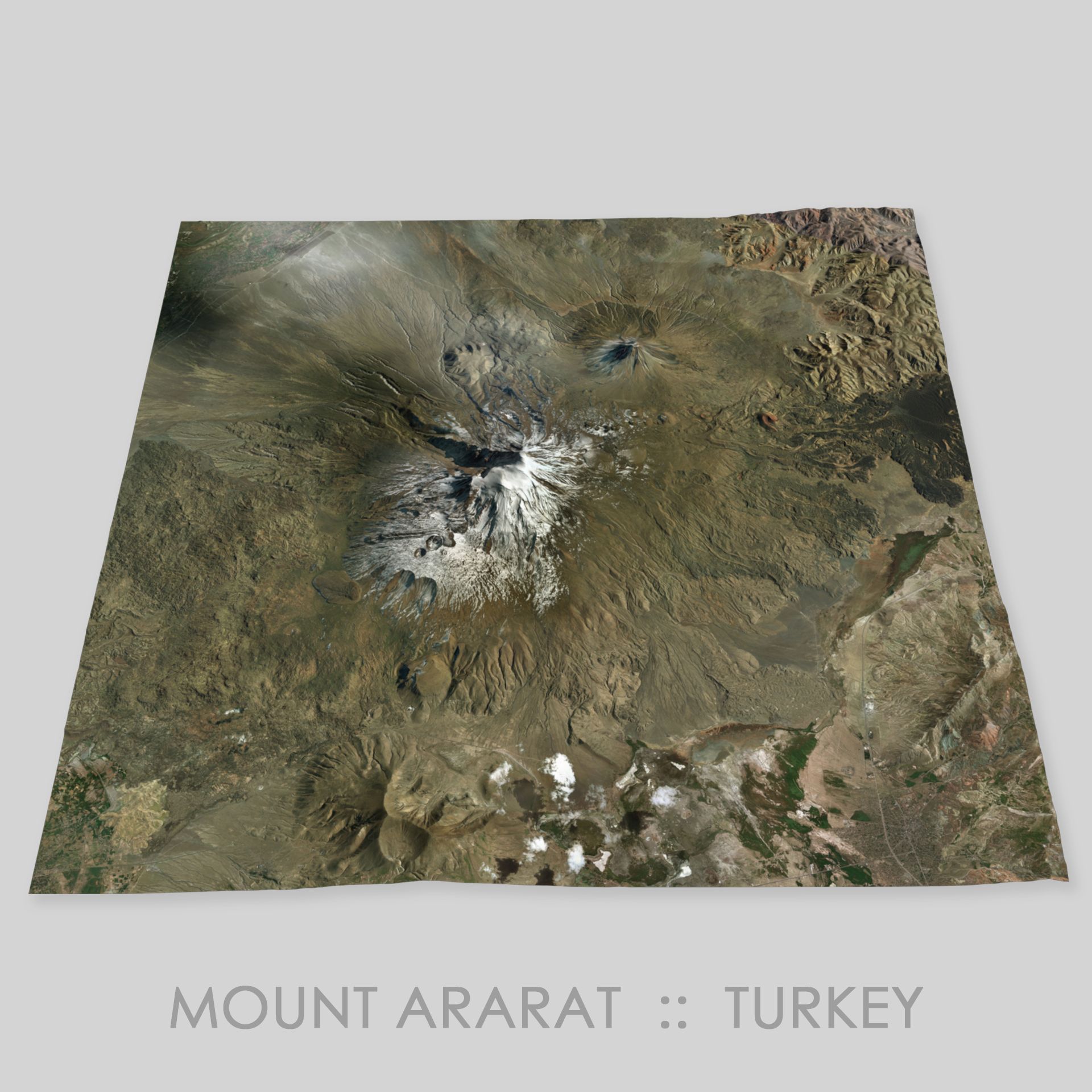
Mount Ararat is a snow-capped and dormant compound volcano in the extreme east of Turkey. It consists of two major volcanic mountains: Greater Ararat, the highest peak in Turkey and the Armenian plateau with an elevation of 5,137m and Little Ararat, with an elevation of 3,896m.
Mount Ararat, has been widely accepted as the resting place of Noah's Ark and the principal national symbol of Armenia.
This is a High Resolution model of the terrain surrounding Mount Ararat.
This model is suitable for 3D presentations, landscaping, Architectural Visualization, video production, simulation of walk throughs and navigation/gaming.
Should be possible to overlay/project realworld GPS coords using WGS84.
Constructed from GIS contour elevation data from different data sources combined and enhanced with different filters and erosion techniques to produce a real world style likeness.
Terrain tiles have been stitched to produce a single seamless low res model which provides a scale accuracy of about 1:1m.
This Terrain model does not include any buildings, trees or any other similar features - only the terrain model is included.
Nov 03, 2019
date added
Apr 18, 2022
last update
Reviews
There are currently no reviews for this product.
Why not be the first one to break the ice?