


Mount Everest schließen Landschaft 3D-Modell


Spezifikationen
- Geometriepolygonal_quads/tris
- Polygone1,000,000
- Scheitelpunkte1,002,001
- TexturenYes
- ManipuliertenNo
- AnimiertNo
- Bereit zum Drucken in 3DNo
- Spielbereit (low poly)No
- UV-kartiertYes
- Unverpackte UVsnone
Beschreibung
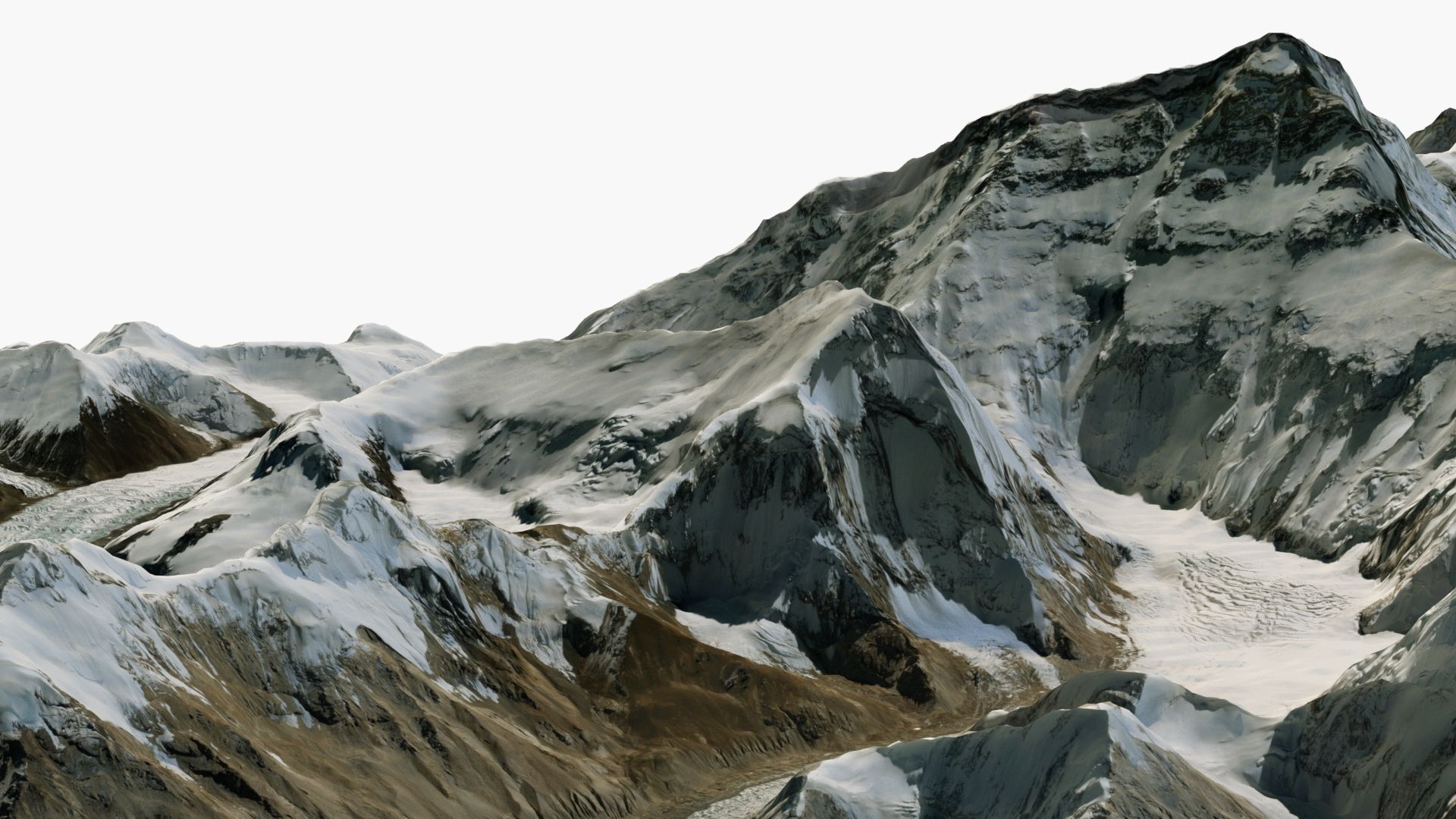
Mount Everest Close-Up Area (20x20 km) - Detailed 3D Model
Enhance your projects with this 3D model of the Mount Everest area, featuring accurate elevation data and high-resolution 20000 X 20000 pixel satellite textures.
Geometry
• Polygons with 4 sides: 100%, Triangles of ngons: 0
• Clean and optimized topology.
• Precise height map from NASA satellite data.
Scene management
• Objects are logically named (following naming conventions) for ease of scene management.
• Scene is properly organized, layered. Gizmos are in correct position and asset is centered.
• Models transforms were reset.
File formats
• 3ds Max • Cinema 4D
• Blender • FBX
• OBJ
All file formats were checked and work without issues in all major 3D software.
About
For a decade we have been delivering high-quality 3D models for professional projects to clients worldwide.
Our models are created to meet industry standards, ensuring quality and time savings for our customers.
Bewertungen
Es liegen noch keine Bewertungen für dieses Produkt vor.
Warum nicht der erste sein, der das Eis bricht?