


ゴベクリテペ 3Dモデル
1


0
訪問
から提出された
kupproduction
仕様
- ジオメトリpolygonal
- 多角形70,000
- 頂点59,137
- テクスチャYes
- 堅いNo
- アニメ化No
- 3Dプリント可能No
- ゲームレディ(低ポリ)No
- UVマップYes
- ラップされていないUVmixed
説明
LowPoly Gobekli Tepe
-3dmax 2016(or higher)and vray 2.20
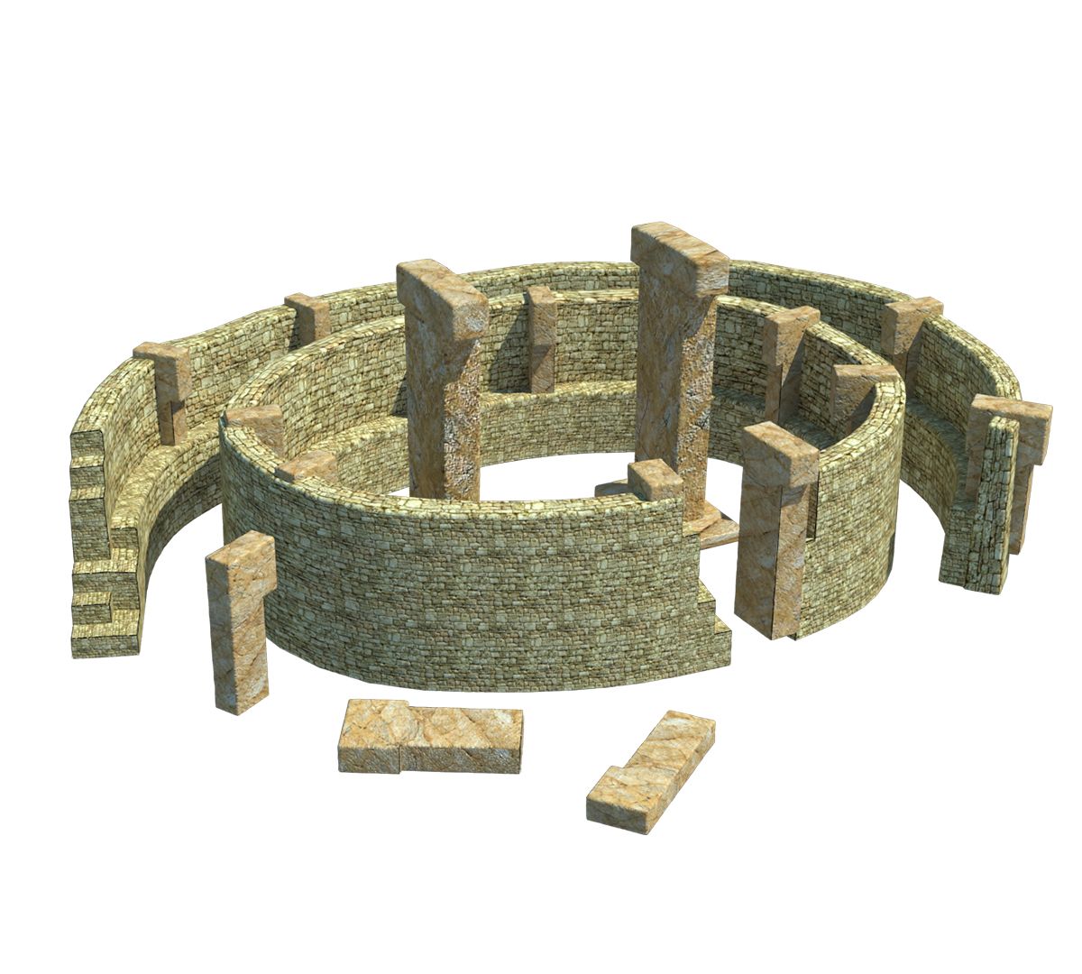
Gbekli Tepe (pronounced [bekli tepe][2]) "Potbelly Hill"[3] in Turkish, is an archaeological site atop a mountain ridge in the Southeastern Anatolia Region of modern-day Turkey, approximately 12 km (7 mi) northeast of the city of anlurfa. The tell has a height of 15 m (49 ft) and is about 300 m (984 ft) in diameter.[4] It is approximately 760 m (2,493 ft) above sea level.
The tell includes two phases of ritual use dating back to the 10th8th millennium BCE. During the first phase, pre-pottery Neolithic A (PPNA), circles of massive T-shaped stone pillars were erected, the world's oldest known megaliths.[5] More than 200 pillars in about 20 circles are currently known through geophysical surveys. Each pillar has a height of up to 6 m (20 ft) and a weight of up to 20 tons. They are fitted into sockets that were hewn out of the bedrock.[6] In the second phase, Pre-Pottery Neolithic B (PPNB), the erected pillars are smaller and stood in rectangular rooms, also with floors of polished lime. The site was abandoned after the PPNB-period. Younger structures date to classical times.
The details of the structure's function remain a mystery. It was excavated by a German archaeological team under the direction of Klaus Schmidt from 1996 until his death in 2014; Schmidt believed that the sites were early neolithic sanctuaries used as a holy site and not used as a settlement.
Jul 31, 2020
追加日
Sep 26, 2021
最後の更新
レビュー
この商品のレビューはまだありません。
氷を砕いた最初の人になろう。
