


Gobekli Tepe 3d model
1


Royalty-vrije LicentieAlle uitgebreide toepassingen
Eenvoudig rendement
Beste prijsgarantie
Werkt uit de doos
0
bezoeken
Ingezonden door
kupproduction
bestek
- Geometriepolygonal
- polygonen70,000
- hoekpunten59,137
- texturesYes
- opgetuigdNo
- AnimatedNo
- Geschikt voor 3D-afdrukNo
- Game Ready (laag poly)No
- UV-gemappedYes
- Onverpakte UV'smixed
Omschrijving
LowPoly Gobekli Tepe
-3dmax 2016(or higher)and vray 2.20
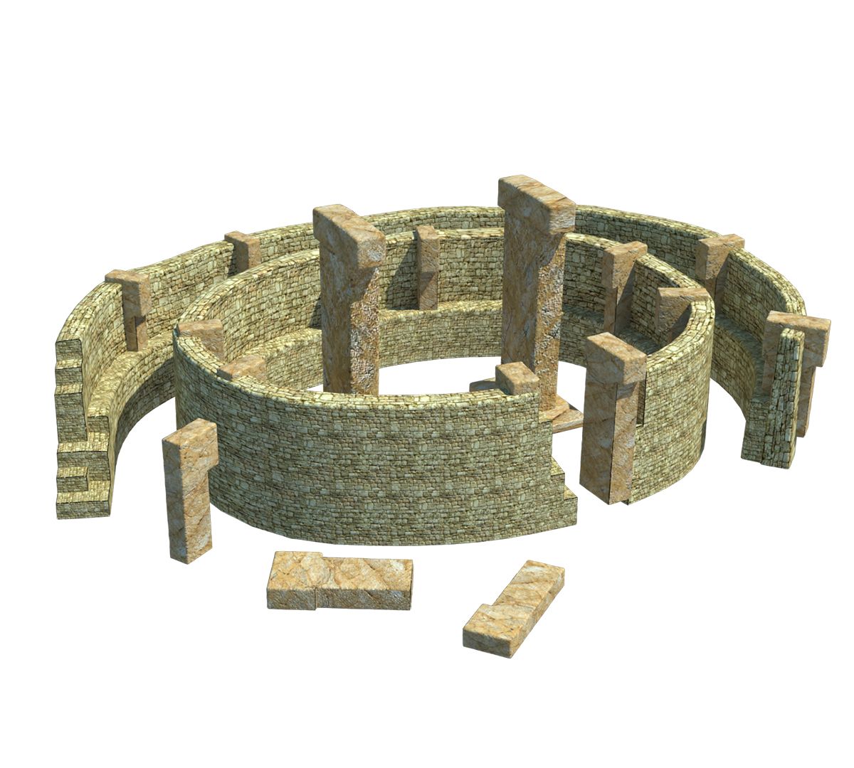
Gbekli Tepe (pronounced [bekli tepe][2]) "Potbelly Hill"[3] in Turkish, is an archaeological site atop a mountain ridge in the Southeastern Anatolia Region of modern-day Turkey, approximately 12 km (7 mi) northeast of the city of anlurfa. The tell has a height of 15 m (49 ft) and is about 300 m (984 ft) in diameter.[4] It is approximately 760 m (2,493 ft) above sea level.
The tell includes two phases of ritual use dating back to the 10th8th millennium BCE. During the first phase, pre-pottery Neolithic A (PPNA), circles of massive T-shaped stone pillars were erected, the world's oldest known megaliths.[5] More than 200 pillars in about 20 circles are currently known through geophysical surveys. Each pillar has a height of up to 6 m (20 ft) and a weight of up to 20 tons. They are fitted into sockets that were hewn out of the bedrock.[6] In the second phase, Pre-Pottery Neolithic B (PPNB), the erected pillars are smaller and stood in rectangular rooms, also with floors of polished lime. The site was abandoned after the PPNB-period. Younger structures date to classical times.
The details of the structure's function remain a mystery. It was excavated by a German archaeological team under the direction of Klaus Schmidt from 1996 until his death in 2014; Schmidt believed that the sites were early neolithic sanctuaries used as a holy site and not used as a settlement.
Jul 31, 2020
Datum toegevoegd
Sep 26, 2021
laatste update
beoordelingen
Er zijn momenteel geen beoordelingen voor dit product.
Waarom niet de eerste zijn om het ijs te breken?