



Peyzaj - Dağ ve Hava Durumu Sistemi 3D model
0


Royalty Free LisansTüm genişletilmiş kullanımlar
Basit iadeler
En iyi fiyat garantisi
Kutunun dışında çalışır
66
ziyaret

Tarafından gönderilmiştir
Prod3D
Özellikler
- Geometripolygonal
- Çokgenler45,000
- Tepe Noktaları22,801
- DokularYes
- hileliYes
- canlandırılmışNo
- 3D Yazdırılabilir HazırNo
- Oyuna Hazır (düşük poli)No
- UV HaritalıYes
- Sarılmamış UV'lernone
Açıklama
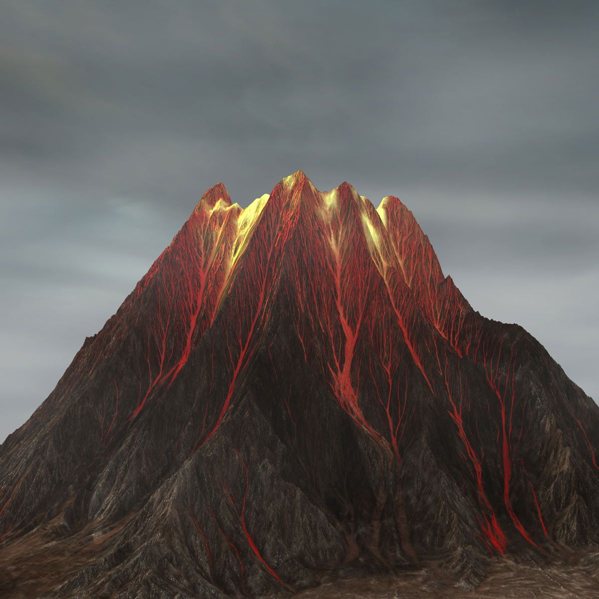
Resulting weathered mountain simulation plus included simulation system.
Create your own weathered mountains in 3ds max or use the one included. Full instructions on how to create your own included.
Full pflow driven erosion system using image render feedback.
The weathering system is designed to erode a base (displaced) mesh using a PFlow system and feedback loop of additive rendering - in essence to bring in the last image rendered in a sequence back in as a background and then render back on top of it.
This is then applied in a displacement modifier which causes the particles to collate within the "erosion", generating an effective result.
Because of this additive process, a blank sequence is required to start from (included), so if you want to create your own erosion maps, you'll need to "reset" the erosion sequence by creating a new full sequence of black frames.
NOTE2 - THIS WILL TAKE A WHILE TO PERFORM THE EROSION SIMULATION!
THIS MUST BE RENDERED IN THE TOP VIEWPORT WHICH IS EDGE TO EDGE THE SAME AS THE UV MAP OF THE DISPLACED PLANE GEOMETRY.
Oct 04, 2019
Ekleme Tarihi
Jul 17, 2023
son Güncelleme
Yorumlar
Bu ürün için henüz hiç yorum yapılmamış.
Neden buzu kıran ilk kişi değilsin?