




Verbessertes_System_von_Parallellen_und_Mmeridianen 3D-Modell
0



Royalty Free LicenseAlle erweiterten Anwendungen
Einfache Rückgabe
Best-Preis-Garantie
Funktioniert aus dem Kasten heraus
0
Besuche

Eingereicht von
AT CAD Team
Spezifikationen
- Geometrieunknown
- Polygone100,000
- Scheitelpunkte100,000
- TexturenYes
- ManipuliertenNo
- AnimiertNo
- Bereit zum Drucken in 3DNo
- Spielbereit (low poly)No
- UV-kartiertNo
- Unverpackte UVsunknown
Beschreibung
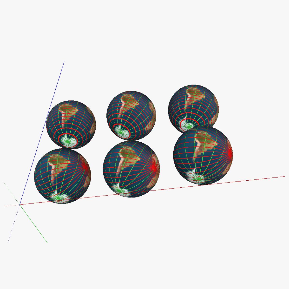
3D model showing a proposed improved system of parallells and meridians for navigation. 6 globes are shown; in the first row of globes regular parallells were kept; the first globe of the first row shows the current system; the second globe shows the the current system with the earth tilted correctly. The third globe has the current "true north" and "true south" changed for the magnetic north/south (on the map this is 115° N 80° W or at about the Queen Elisabeth islands near the Ellesmere islands). In the second row, the parallells were swapped with intersecting lines (similar to the system currently used for the meridians); but then horizontally rather than vertically. The second globe again includes the axial tilt of obliquity, and finally, the third one also has the true north/south swapped for the magnetic north/south. See the "Purchasing_the_models" link at appropedia's AT_CAD_Team for additional information on the model
Aug 13, 2020
Datum hinzugefügt
Feb 04, 2022
letztes Update
Bewertungen
Es liegen noch keine Bewertungen für dieses Produkt vor.
Warum nicht der erste sein, der das Eis bricht?