



Verbeterd_systeem_van_parallellen_en_meridianen 3d model
0



Royalty-vrije LicentieAlle uitgebreide toepassingen
Eenvoudig rendement
Beste prijsgarantie
Werkt uit de doos
0
bezoeken

Ingezonden door
AT CAD Team
bestek
- Geometrieunknown
- polygonen100,000
- hoekpunten100,000
- texturesYes
- opgetuigdNo
- AnimatedNo
- Geschikt voor 3D-afdrukNo
- Game Ready (laag poly)No
- UV-gemappedNo
- Onverpakte UV'sunknown
Omschrijving
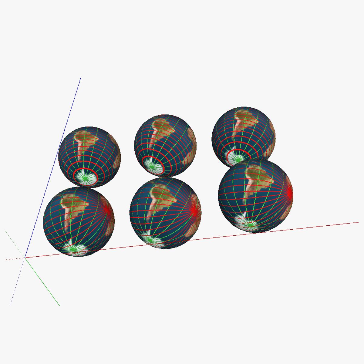
3D model showing a proposed improved system of parallells and meridians for navigation. 6 globes are shown; in the first row of globes regular parallells were kept; the first globe of the first row shows the current system; the second globe shows the the current system with the earth tilted correctly. The third globe has the current "true north" and "true south" changed for the magnetic north/south (on the map this is 115° N 80° W or at about the Queen Elisabeth islands near the Ellesmere islands). In the second row, the parallells were swapped with intersecting lines (similar to the system currently used for the meridians); but then horizontally rather than vertically. The second globe again includes the axial tilt of obliquity, and finally, the third one also has the true north/south swapped for the magnetic north/south. See the "Purchasing_the_models" link at appropedia's AT_CAD_Team for additional information on the model
Aug 13, 2020
Datum toegevoegd
Feb 04, 2022
laatste update
beoordelingen
Er zijn momenteel geen beoordelingen voor dit product.
Waarom niet de eerste zijn om het ijs te breken?
