





Improvement_system_of_parallells_and_meridians 3Dモデル
0



0
訪問

から提出された
AT CAD Team
仕様
- ジオメトリunknown
- 多角形100,000
- 頂点100,000
- テクスチャYes
- 堅いNo
- アニメ化No
- 3Dプリント可能No
- ゲームレディ(低ポリ)No
- UVマップNo
- ラップされていないUVunknown
説明
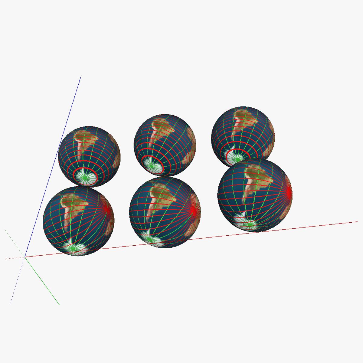
3D model showing a proposed improved system of parallells and meridians for navigation. 6 globes are shown; in the first row of globes regular parallells were kept; the first globe of the first row shows the current system; the second globe shows the the current system with the earth tilted correctly. The third globe has the current "true north" and "true south" changed for the magnetic north/south (on the map this is 115° N 80° W or at about the Queen Elisabeth islands near the Ellesmere islands). In the second row, the parallells were swapped with intersecting lines (similar to the system currently used for the meridians); but then horizontally rather than vertically. The second globe again includes the axial tilt of obliquity, and finally, the third one also has the true north/south swapped for the magnetic north/south. See the "Purchasing_the_models" link at appropedia's AT_CAD_Team for additional information on the model
Aug 13, 2020
追加日
Feb 04, 2022
最後の更新
レビュー
この商品のレビューはまだありません。
氷を砕いた最初の人になろう。