


Improved_system_of_parallells_and_meridians modèle 3D
0


Licence Libre de DroitsToutes les utilisations prolongées
Retours simples
Garantie du meilleur prix
Fonctionne hors de la boîte
0
visites
Proposé par
AT CAD Team
Caractéristiques
- Géométrieunknown
- Des polygones100,000
- Sommets100,000
- Les texturesYes
- GrééNo
- AniméNo
- Prêt pour l'impression 3DNo
- Jeu Prêt (low poly)No
- UV mappéNo
- UV non emballésunknown
La description
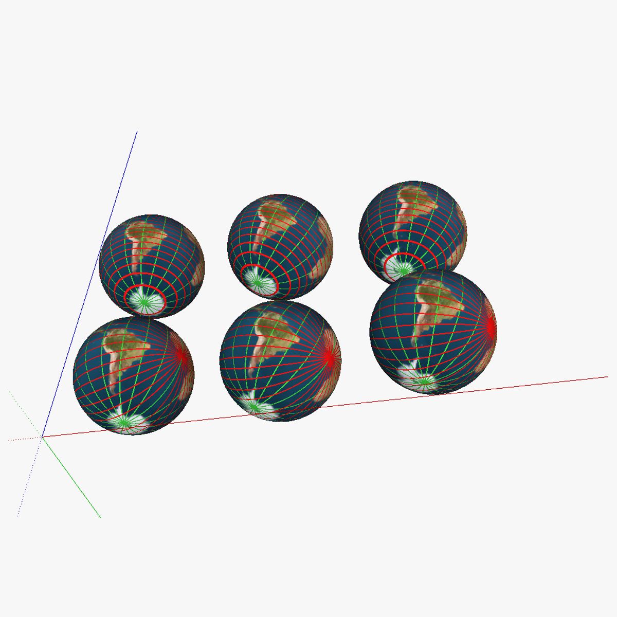
3D model showing a proposed improved system of parallells and meridians for navigation. 6 globes are shown; in the first row of globes regular parallells were kept; the first globe of the first row shows the current system; the second globe shows the the current system with the earth tilted correctly. The third globe has the current "true north" and "true south" changed for the magnetic north/south (on the map this is 115° N 80° W or at about the Queen Elisabeth islands near the Ellesmere islands). In the second row, the parallells were swapped with intersecting lines (similar to the system currently used for the meridians); but then horizontally rather than vertically. The second globe again includes the axial tilt of obliquity, and finally, the third one also has the true north/south swapped for the magnetic north/south. See the "Purchasing_the_models" link at appropedia's AT_CAD_Team for additional information on the model
Aug 13, 2020
date ajoutée
Feb 04, 2022
dernière mise à jour
Avis
Il n'y a actuellement aucun avis sur ce produit.
Pourquoi ne pas être le premier à briser la glace?
